


Neola Voting District, Duchesne County, Utah
About
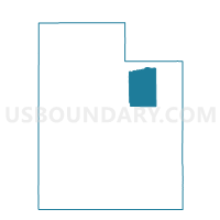
Outline

Summary
| Unique Area Identifier | 678801 |
| Name | Neola Voting District |
| County | Duchesne County |
| State | Utah |
| Area (square miles) | 259.28 |
| Land Area (square miles) | 257.81 |
| Water Area (square miles) | 1.47 |
| % of Land Area | 99.43 |
| % of Water Area | 0.57 |
| Latitude of the Internal Point | 40.61007370 |
| Longtitude of the Internal Point | -110.05578220 |
Maps


Graphs
Select a template below for downloading or customizing gragh for Neola Voting District, Duchesne County, Utah


Neighbors
Neighoring Voting District (by Name) Neighboring Voting District on the Map
- Altamont Voting District, Duchesne County, UT
- Ballard Voting District, Uintah County, UT
- Bluebell Voting District, Duchesne County, UT
- Lapoint Tridell A Voting District, Uintah County, UT
- Manila Voting District, Daggett County, UT
- Oakley Voting District, Summit County, UT
- Roosevelt 1 Voting District, Duchesne County, UT
- Roosevelt 4 Voting District, Duchesne County, UT
- Whiterocks Voting District, Uintah County, UT
Top 10 Neighboring County Subdivision (by Population) Neighboring County Subdivision on the Map
- Roosevelt CCD, Duchesne County, UT (14,760)
- Kamas CCD, Summit County, UT (6,763)
- Uintah and Ouray CCD, Uintah County, UT (5,753)
- West Daggett CCD, Daggett County, UT (886)
- North Duchesne CCD, Duchesne County, UT (6)
Top 10 Neighboring Place (by Population) Neighboring Place on the Map
Top 10 Neighboring Unified School District (by Population) Neighboring Unified School District on the Map
- Uintah School District, UT (32,588)
- Duchesne School District, UT (18,607)
- South Summit School District, UT (7,001)
- Daggett School District, UT (1,059)
Top 10 Neighboring State Legislative District Lower Chamber (by Population) Neighboring State Legislative District Lower Chamber on the Map
- State House District 54, UT (42,563)
- State House District 55, UT (38,435)
- State House District 53, UT (37,757)
Top 10 Neighboring State Legislative District Upper Chamber (by Population) Neighboring State Legislative District Upper Chamber on the Map
Top 10 Neighboring 111th Congressional District (by Population) Neighboring 111th Congressional District on the Map
Top 10 Neighboring Census Tract (by Population) Neighboring Census Tract on the Map
- Census Tract 9406, Duchesne County, UT (7,128)
- Census Tract 9402.01, Uintah County, UT (5,753)
- Census Tract 9403, Duchesne County, UT (3,847)
- Census Tract 9601, Daggett County, UT (1,059)
- Census Tract 9642.03, Summit County, UT (103)